


Jimmy Cornell has spent half a century sailing and mapping the globe. He shares how bluewater cruising and ocean routing have changed.
When I started planning my first voyage in the early 1970s there was only one book dealing specifically with ocean routing: the British Admiralty Ocean Passages for the World, first published in 1895.
The edition available (the third, published in 1973), had very little information relevant for sailing yachts with its focus on well-established commercial routes. While those details still made interesting reading, they were very different from those routes sailed by modern cruising yachts.
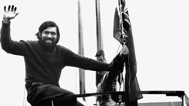
Jimmy Cornell sets off from London at the start of his 1975 round the world voyage.
Photo: Jimmy Cornell
As I started preparing for my passage from La Palma to Barbados in November 1976, the only information for a passage from the Canary Islands to the Caribbean was to proceed west on a great circle route and cross the 25° parallel between 25° and 30° to reach the north-east trade winds as soon as possible. It also mentioned the risk of tropical storms between June and mid-November.
So this is what I did. We left La Palma on 15 November, crossed the 25° parallel six days later, but it took us five more days to find steady north-east winds. We arrived in Barbados on 11 December, having sailed 2,697 miles in 26 days.
All through our six-year 58,000-mile voyage I gathered material on offshore routes, wind and weather conditions, and on my return started work on the kind of book that I’d have liked to have had when I was planning our round the world voyage.
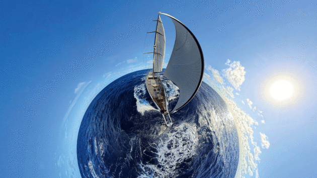
Photo: Oyster World Rally
My research took me from the British Library to the Maritime Museum in Greenwich, where I was given permission to study the original logbooks of ships that had roamed the oceans in previous centuries. I was even allowed to consult Captain Cook’s original logs, and I can still feel the thrill of seeing the neat writing of the man whom I regard as the greatest navigator of all times.
My own experience, and the lessons learned from those captains, have formed the basis of my attitude to routing. Put simply, it is to do your best to be in the right place at the right time and, conversely, to avoid being in the wrong place at the wrong time.
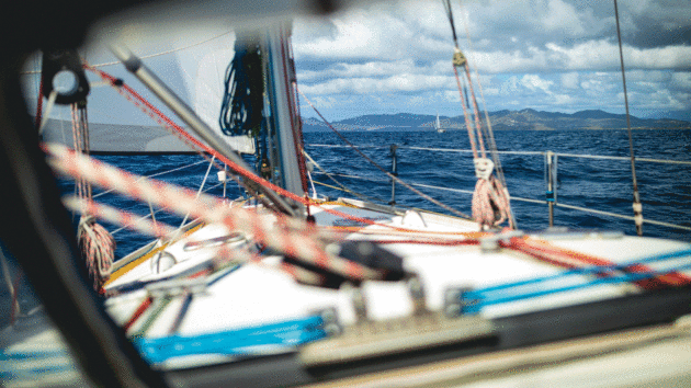
Making landfall in the Caribbean marks the first ocean passage for many world voyagers. Photo: Grand Large Yachting World Odyssey
First-hand experience
The tactics outlined in the first edition of World Cruising Routes, and those that followed, observed that basic principle, but also attempted to help cruisers benefit from favourable sailing conditions.
World Cruising Routes listed the favourable periods for every passage, the safest time, with details of tropical storm seasons and areas affected by them, the UK and US charts for the area to be sailed, and the cruising guides covering the destination area. The accompanying comments referred to prevailing winds and currents, local conditions, suggested tactics for that route, and recommended landfalls.
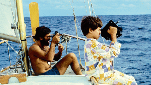
It was very much influenced by the experience gained, and the observations made, during my first round the world voyage between 1975 and 1981. During the voyage with my wife, Gwenda, and our two young children, we’d made detours to many places off the usual sailing routes, sometimes becoming the first yacht to have called there.
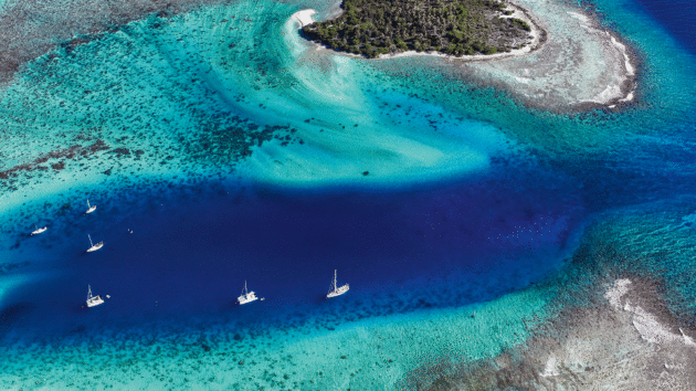
Finding paradise: technology has changed ocean voyaging, but the need for verified information remains constant. Photo: James Tomlinson/Oyster World Rally
World Cruising Routes also reflected my own style of navigation. Our first Aventura’s navigation system was quite rudimentary with only a sextant, a battery-operated depth sounder and a radio direction finder (RDF).
The latter was only useful for inshore navigation within 25 to 30 miles of land where it was possible to tune into AM stations or coastal radio beacons to calculate your position by triangulation. On offshore passages, astronavigation was the only way to work out where you were.
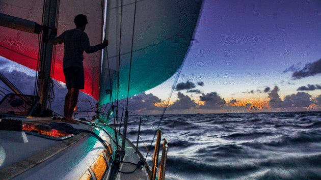
Setting off on a bluewater adventure is still the greatest way to explore the world! Photo: Tor Johnson
Changing tech
Over four decades World Cruising Routes has evolved – both reflecting my own peripatetic sailing life, and also the arrival of revolutionary aids to navigation, from GPS to satellite communications and AIS to electronic charts, and their impact on offshore navigation.
These developments made it possible for the second edition, published in 1990, to list waypoints for each route. New routes were added as boats ventured further afield, and new cruising grounds were being discovered. More detailed landfall information, as well as official ports of entry and clearance formalities, were included to assist in passage planning.
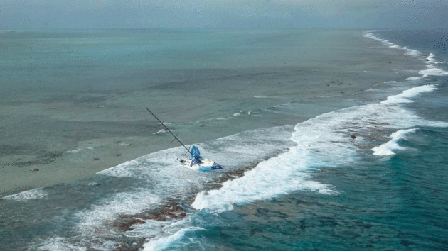
A routing error saw Volvo Race yacht Team Vestas Wind wrecked on charted shoals in the Indian Ocean. Photo: NCG Operations Room, MRCC Mauritius/Getty
In the following years, on Aventura II, I completed my second circumnavigation and became increasingly aware of several changes in weather conditions compared to the past.
I noted some of these changes in the third edition (published 1995), and many of the points remain salient today:
‘Sailing routes depend primarily on weather, which changes little over the years. However, possibly as a result of the profound changes that have occurred in the ecological balance of the world environment, there have been several freak weather conditions in recent years.
‘Their most worrying aspect is that they are rarely predicted, occur in the wrong season, and often in places where they have not been known before.
‘The unimaginable force of megahurricanes should be a warning of worse things to come.’
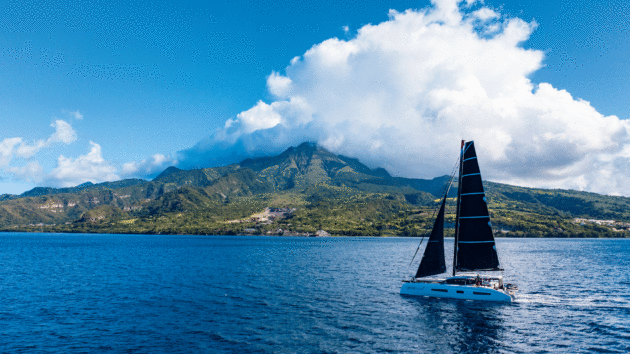
There are now multiple options for a world tour, including rallies organised by brands such as Grand Large. Photo: Grand Large Yachting World Odyssey
Innovations
Future editions took into account the observations I had made from the growing popularity of the transatlantic and round the world rallies that I was running at the time, and my own voyages to Antartica and Alaska.
But the arrival of chartplotters and electronic charts in the early 2000s was the most fundamental innovation in offshore navigation since the invention of the sextant. The benefits in terms of both safety and accuracy were unquestioned until the running aground of the 65ft yacht Team Vestas Wind in November 2014 during the Volvo Ocean Race.
Vestas was wrecked on the St Brandon reef, north of Mauritius in the South Indian Ocean. The navigator had failed to zoom in far enough on the electronic chart to notice the shallow reef. That area, known as the Cargados Carajos Shoals, is clearly marked on paper charts.
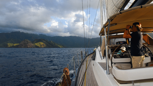
Approaching Nuku Hiva in the Marquesas. Photo: Rick Tomlinson/Oyster World Rally
My immediate reaction on hearing about the grounding was to check my book, and it was indeed mentioned as a hazard. However, I’d not have expected my book to be on board a racing yacht. Nor, for that matter, on a submarine! One of the greatest compliments I ever received came from a most unexpected direction.
While in Las Palmas before the start of the ARC, a participant who had been an officer in the Royal Navy barged into my office and exclaimed, “Jimmy, you will never believe this. I have just visited a British nuclear submarine that is here on a goodwill mission and guess what? On the shelf above the nav table I saw a copy of your Routes!”
I asked the captain why on earth he’d carry that doorstopper of a book with him?
“He responded: ‘So I know where those silly yachts go, to be extra careful not to smash into one when we surface’.”
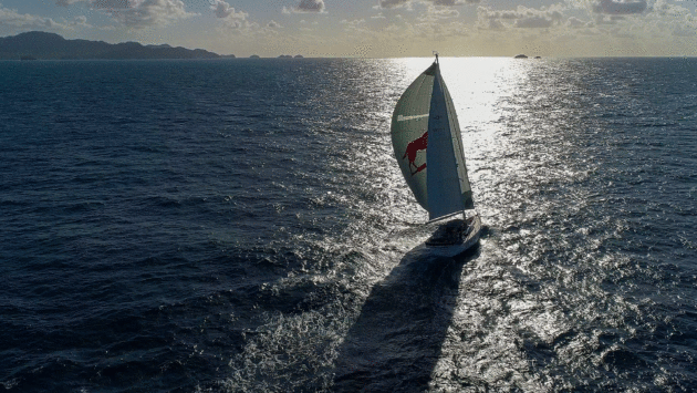
Spinnaker sailing between San Blas and Portobelo, Panama. Photo: Rick Tomlinson/Oyster World Rally
I made sure the seventh edition (2014), mentioned all known hazards in areas crossed by sailing routes by giving their coordinates, and listing waypoints that avoid isolated reefs, unlit atolls, offshore oil fields and wind farms.
We also revised some route planning tactics on popular cruising routes based on the work we did for Cornells’ Ocean Atlas (2011), which included information on changes that had occurred in the wind systems of the world based on 20 years of satellite observations.
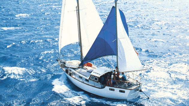
Cornell and family’s first circumnavigation aboard Aventura. Photo: Jimmy Cornell
Article continues below…
Getting into bluewater cruising: ‘I wanted to see the world… and I just kept going’
All the luckiest kids I know spent their childhoods messing about in boats. They had water-loving parents and garages filled…
‘Lava explodes way up into the sky above us’ – sailing among active volcanoes
Our hulls cut through the translucent waters of the lagoon around Fiji’s largest island, Viti Levu. As we make our…
Changing routes
The growing interest among cruisers in sailing to more challenging destinations was reflected in the eighth edition (2018), which was expanded to include several high latitude routes. It was published soon after my own successful transit of the Northwest Passage on Aventura IV, in some ways a trip that became possible due to the consequences of climate change.
My concern for the current state of the ocean environment stems from my own observations during five decades of roaming the seas of the world and noticing the disastrous changes that have occurred over the years. One of the most noticeable phenomena is the decrease in the regularity and reliability of trade winds, as witnessed by sailors on some of the frequently travelled ocean routes.
However, the most significant change has been the increased intensity and extent of tropical cyclones, both in the duration of the critical seasons and the areas affected. As this phenomenon has such a major impact on voyage planning, and safety generally, the ninth edition of World Cruising Routes (2022) highlighted relevant information for areas of the world affected.
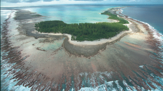
Mururoa Atoll in French Polynesia – site of French nuclear tests between 1966 and 1996. Photo: Patrick Durand/Sygma/Getty
To find out how today’s sailors view this crucial topic I conducted a survey among long distance sailors, the significant majority of whom had completed a circumnavigation in recent years. All were acutely aware of this new challenge and stated that they’d either revise or modify their future plans accordingly. Only a few were prepared to abandon them.
On that note, I wish to reassure all those who are planning a voyage, that sailing on your own boat is still the best and most rewarding way to explore our planet. Don’t leave it too late.
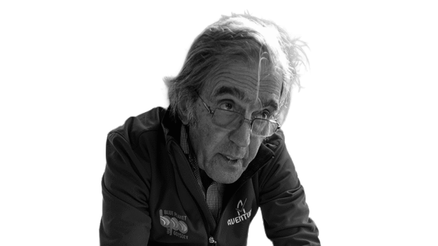
Jimmy Cornell is the doyen of modern ocean cruising. He founded the Atlantic Rally for Cruisers (ARC) transatlantic rally in 1986. Photo: Jimmy Cornell
In the dark
My most frightening experience during my first world voyage in the 1970s is an example of what it meant to navigate through a critical area in those pre-GPS days.
Having reached the Pacific Ocean via the Panama Canal in late 1976, rather than take the traditional route to French Polynesia via the Galapagos Islands, we decided to get there by a rarely sailed route via Peru, Easter Island, Pitcairn and on to Mangareva, in the Gambier Islands. We had a wonderful reception there as the only sailing yacht to call in over a year.
When the time came to resume our voyage, we encountered a complication. France was conducting nuclear tests on the Mururoa and Tangataufa atolls, and we had to obtain permission from the French authorities for the passage to Tahiti. When the response came, I was alarmed to see that it prescribed a route that had to clear the prohibited area around the nuclear testing sites by 50 miles.
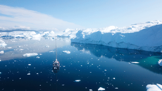
High latitudes sailing has increased in popularity, such as this 2024 transit of the Northwest Passage by three Garcia yachts. Photo: Garcia Yachts
The suggested route cut across the southern Tuamotus, past the uninhabited atolls of Maria, Tureia and Vanavana, set among a cluster of similar hazards in that notorious area aptly called the Dangerous Archipelago by Captain Cook.
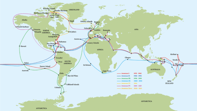
Cornell’s circumnavigation routes in various Aventuras from 1975 to 2021. Photo: Jimmy Cornell
The rules were very strict and did not allow for any deviation from the approved route. We simply had no choice.
With Maria at a distance of 90 miles from Mangareva, we left late in the day planning to sail during the night in open waters and pass the atoll in daylight. At daybreak the following morning I was shocked to see Maria’s low-profile peeping over the horizon several miles behind us.
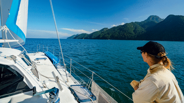
South-east Asia is becoming popular among cruisers looking to extend their voyaging. Photo: David Bristow
A quick sun sight showed that in the night we’d gained some 20 miles on our estimated position having been driven by a swift north-west-setting current, and we’d sailed past the unlit Maria in the darkness.
By now my astronavigation had become reasonably accurate – usually to within five miles of our actual location – so throughout the day I kept taking sights and by nightfall I reckoned to have some 100 miles of open water ahead of us. This gave us a safety margin of about 90 miles after allowing for an estimated 2.5-knot current at a speed of 5 knots.
My main concern was that, pushed by a stronger current, as had happened during the previous night, it was a distance we could easily cover in the 12 hours of darkness.
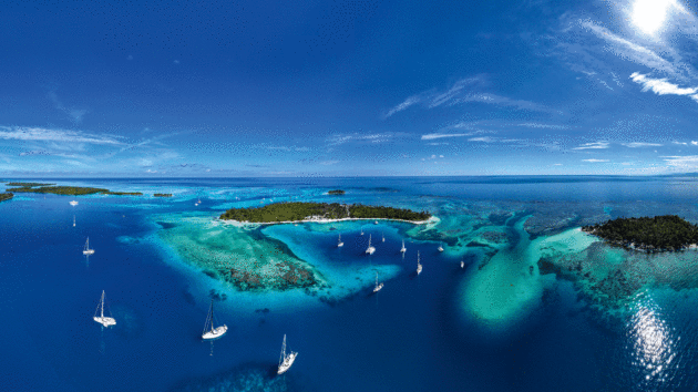
San Blas islands off Panama, the traditional jump-off point for a Pacific crossing. Photo: Rick Tomlinson / Oyster World Rally
We depended entirely on the classic dead reckoning navigation. Every hour I wrote down in the logbook the course steered, and the distance covered, the latter based on readings provided by the trailing log. The counter indicated our speed through the water, which allowed me to calculate our estimated speed and thus the distance. Hence the term dead reckoning – not exactly rocket science.
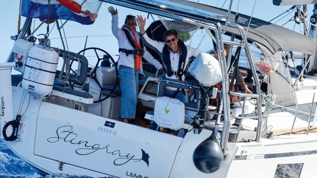
Looking forward to adventure at the start of of an ARC+ event. Photo: Paul Wyeth/WCC
During the squally night, the overcast sky made it impossible to take any star sights, so I tried to slow down by reducing sail, but in the 20- to 25-knot wind it didn’t make much difference. I spent a gut-wrenching night peering blindly ahead into the darkness and listening out for the boom of swell breaking on a windward reef.
Just as dawn started lightening the eastern horizon, I glimpsed straight ahead of us, at less than half a mile distance, the tell-tale white line of breakers. Tureia! I altered course to port, and steered Aventura at a safe distance off the southern edge of the atoll.
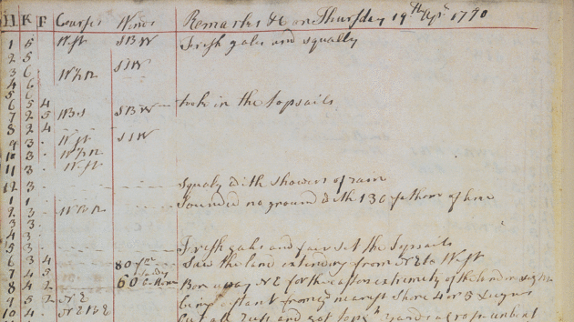
Cornell’s initial research included Captain Cook’s Endeavour log books. This from 1770 records his first sighting of the previously unknown eastern coast of Australia. Photo: Heritage Images/Getty
In the half-light the atoll looked much smaller than I’d expected, but thought that might be an optical illusion. It was only a couple of hours later, when the sun was high enough to take a sight, that I managed to work out our approximate position – and realised with an almighty shock that the atoll we’d just passed had been in fact Vanavana, and that a stronger than expected current had pushed us much further west than I’d allowed for.
We’d passed Tureia in the dark without seeing it, a discrepancy in my estimation of some 40 miles. Another 10 minutes of darkness and we’d have been wrecked on Vanavana’s windward reef. A Dangerous Archipelago indeed!
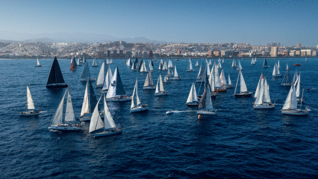
The ARC celebrated its 40th running last year and has seen thousands of sailors make their first ocean voyage. Photo: Paul Wyeth/WCC
 If you enjoyed this….
Yachting World is the world’s leading magazine for bluewater cruisers and offshore sailors. Every month we have inspirational adventures and practical features to help you realise your sailing dreams.Build your knowledge with a subscription delivered to your door. See our latest offers and save at least 30% off the cover price.
Note: We may earn a commission when you buy through links on our site, at no extra cost to you. This doesn’t affect our editorial independence.