



This year’s global weather is being dominated by a ‘Super El NiÑo’ – but how will it affect sailors? Dr Elizabeth Alberts reports
In June, scientists at the UK Met Office announced that the world had officially entered an ‘El Niño’ – a naturally occurring phenomenon that brings warmer global temperatures, shifting wind patterns and more intense weather events.
But experts say this El Niño is likely to be stronger than many previous ones, leading some to call it a ‘super’ or ‘Godzilla’ El Niño. In fact, models now indicate there is more than an 80% chance it will become one of the strongest on record, ranking it ‘among the largest El Niño events in the historical record going back to 1950,’ according to the US NOAA (National Oceanic and Atmospheric Administration).
Not only that, but models show there’s a 97% chance it will last until early 2027.
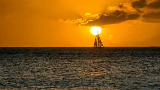
Sailing off Waikiki, Hawaii – the eastern Pacific will experience rising temperatures during the current El Niño. Photo: 400tmax/Getty
“This particular El Niño is predicted to fall out of our measured range of prior El Niños,” Chris Bedford, legendary sailing forecaster and marine meteorologist (Sailing Weather Service), told Yachting World. “That’s why it’s called a ‘super’ El Niño.”
Scientists have yet to reach a consensus on whether human-driven climate change is influencing the strength or frequency of El Niño events. However, it is understood that climate change is amplifying the impacts of the El Niño.
It steadily warms the atmosphere and oceans, which are now storing unprecedented amounts of heat. A warmer atmosphere also holds more moisture, which can magnify the effects of El Niño, increasing the likelihood of more powerful heatwaves, heavier rainfall and, in some regions, more severe drought.
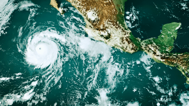
Pacific storms generated by El Niño – this is Hurricane Genevieve south-west of Mexico in 2026. Photo: Frank Ramspott/NASA/Getty
Most critically for bluewater sailors, the El Niño typically brings a stormier Pacific and a quieter Atlantic, but the impacts can vary – and this El Niño might introduce a level of unpredictability due to its strength.
“We don’t know exactly how the atmosphere is going to react because we’ve never been here before,” Bedford said. “Who’s to say when we spike over some threshold, it responds in a different way?”
So while no-one can say exactly how this El Niño will evolve, sailors can at least inform themselves to get ahead of the changing conditions.
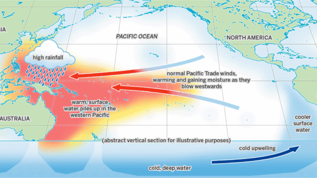
How weather patterns generally manifest across the Pacific during a ‘normal’ or neutral year. Photo: Richard Thomson
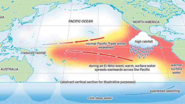
During an El Niño event warm water spreads east across the Pacific, shifting winds, rain and weather worldwide. Photo: Richard Thomson
What is El Niño?
In a recent webinar briefing for sailors, Arnaud Monges, meteorologist at the PredictWind weather forecasting and routing platform, begins his explanation of El Niño with the simplest definition as “when the Pacific Ocean is warmer than usual” (see full webinar at help.predictwind).
El Niño is one phase of a naturally occurring climate pattern known as the El Niño-Southern Oscillation (ENSO), which is driven by changes in ocean temperatures and wind patterns across the tropical Pacific.
The oscillation between these two phases will influence weather far beyond the Pacific Ocean, affecting rainfall, storms and temperatures around the world. Under normal, or ‘neutral’, conditions, trade winds steadily blow from east to west along the equator, pushing warm surface waters from the western coast of South America toward Asia and Australia.
As this warm water moves west, cold, nutrient-rich water rises up from the deep ocean along South America’s west coast in a process called upwelling.
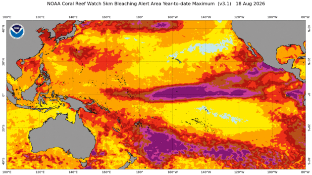
Pacific sea temperature surges in August 2026. Photo: NOAA
But an El Niño event changes all this. Trade winds weaken or even reverse in the western Pacific. As a result, warm waters in the Pacific spread eastward toward the Americas, which suppresses the upwelling of cold water off the South American coast. These changes disrupt the Pacific’s normal pattern of pressure.
Easterly trade winds become weaker or more inconsistent, allowing warm, moisture-laden westerlies to take over in the middle latitude. This can cause unusually heavy rainfall along the Pacific coast of South America, with a risk of flooding and landslides. El Niño is also associated with warmer, drier winters across Canada, northern United States, and parts of Europe.
Eventually, El Niño will weaken, and the Pacific will transition into a La Niña, the opposite phase in the ENSO cycle. During the La Niña, trade winds not only regain their strength, but become more intense. The winds push warm water toward the western Pacific, which leads to powerful upwelling of cold water along the South American coast.
The sea temperature in the central and eastern equatorial Pacific Ocean drops, while temperatures climb in the western Pacific. Air pressure also drops across the western Pacific, leading to increased rainfall in places like Australia, Indonesia and parts of Southeast Asia. Another impact of the La Niña is a more active hurricane season in the Atlantic.
The entire ENSO cycle can last anywhere from two to eight years, with the El Niño phase typically nine to 18 months, and La Niña usually one to two years.
When the cycle finishes, the Earth can sit in a neutral phase for a few months to several years. Before the onset of the current El Niño, the planet was in a neutral phase between April and June 2026 Monges says that typically an El Niño oscillation reaches maximum amplitude between October to February. The current oscillation is forecast to peak around Christmas time.
Climate change effects
While El Niño can temporarily raise sea surface temperatures, the oceans have also been steadily warming over a long period of time due to human-driven climate change. And the rate of warming is only getting faster. Between 1985 and 1989, sea surface temperatures warmed at a rate of about 0.06°C per decade.
Then, between 2019 and 2023, that rate had climbed to 0.27°C per decade, meaning the oceans were warming 4.5 times faster than they were in the late 1980s.
This rapid warming is largely due to the ocean’s capacity to absorb and store heat. It’s estimated that the world’s oceans have absorbed about 90% of the excess heat from greenhouse gas emissions. As a result, the oceans have acted as a remarkable buffer against climate change, but at an enormous cost to marine ecosystems.
As temperatures rise, the impacts ripple through marine ecosystems, driving coral bleaching, kelp forest die-offs, ocean deoxygenation, and fishery disruptions. Warmer oceans also drive more extreme weather.
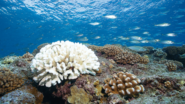
Bleached coral in French Polynesia as a result of sea temperature rises. Photo: Brett Monroe Garner/Getty
“Our oceans are getting warmer and warmer because of climate change,” Professor Liz Bentley, chief executive of the Royal Meteorological Society in the UK and the president of the European Meteorological Society, explains.
“So when you get these El Niño events, you’ve already turned the thermostat up on the ocean, so they’re bound to be higher because of climate change.”
This summer, global average sea surface temperatures reached the highest levels on record, with a temperature of 21.1°C recorded on August 22, beating a previous high of 20.89°C from 2023. With an El Niño event expected to bring additional warming, scientists warn that ocean temperatures may remain at record levels in the months ahead.
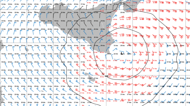
Increased sea temperatures in the Med can lead to strong weather such as Medicanes, here forming off Italy and Sicily. Photo: wetterwelt.de
“Sea surface temperatures could increase by 2.5°C or maybe 3°C above average,” Professor Bentley says. “That’s a huge increase in sea surface temperatures, which will have some big impacts on global climate systems.”
Besides the El Niño, many other factors could influence weather around the world. For instance, Bentley says Arctic ice loss, which can alter atmospheric circulation and weather patterns, may have a stronger influence on the North Atlantic than El Niño itself.
Scientists are also studying how the loss of Arctic sea ice is affecting the Atlantic Meridional Overturning Circulation (AMOC), a system of Atlantic Ocean currents that carries warm surface water northward while transporting colder, denser water south.
There is growing evidence that the AMOC is slowing, and some studies even suggest it could collapse later this century, with potentially catastrophic consequences. For example, Bentley says that an AMOC collapse could bring far more extreme temperatures to the UK, with bitterly cold winters that descend into an ‘ice age’ and exceptionally hot summers.
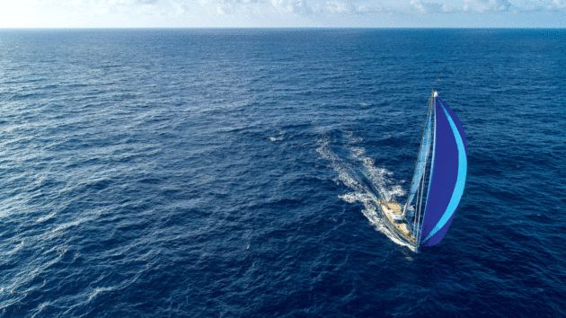
A classic Pacific tradewinds passage for the Oyster World Rally from Galapagos to the Marquesas. Photo: Rick Tomlinson/Oyster World Rally
El Niño in the Pacific
The El Niño will have knock-on effects for sailors in many parts of the world, but will particularly impact those sailing through the Pacific. Arnaud Monges told Yachting World that Pacific crossings might be “slower and less predictable” due to changes in wind direction.
“For anyone doing Panama to Galápagos, French Polynesia, Fiji or Australia, trade winds will be weaker and less consistent than normal, and can even reverse temporarily in the western Pacific,” Monges said.
The critical thing is that weather will be disrupted globally, so sailors need to prioritise careful checking of the forecast and allow ample time as good weather windows may be shorter. Weather may not follow similar patterns to previous year’s conditions.
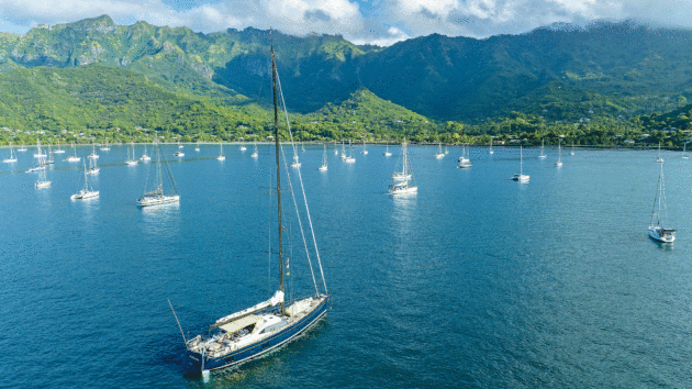
Visiting Pacific destinations like the idyllic anchorage of Nuku Hiva in the Marquesas will require a close eye on forecasts this season. Photo: Rick Tomlinson/Oyster World Rally
Additionally, some parts of the Pacific will be stormier due to a higher amount of energy being present in the Pacific Basin.
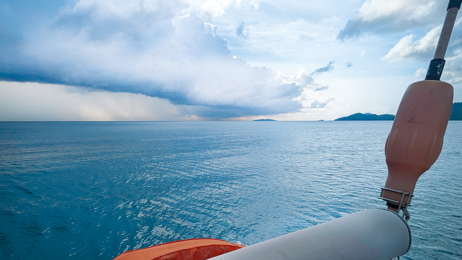
“Convection is shifting into the middle of the Pacific, concentrated around French Polynesia and Hawaii,” Monges said. “This means more thunderstorms, squalls, sudden wind shifts and reduced visibility, plus a higher chance of hurricane activity in the Central Pacific during El Niño years, though several other factors still need to align for one to actually form.
“This does not mean sailors should avoid those areas all together, as those are just higher probabilities that those conditions will occur,” Monges added.
“There will also be ideal moments for sailing there. The idea is to use forecasts to pick those best moments.” There may also be increased tropical cyclone activity in the central Pacific (Hawaii and French Polynesia).
Article continues below…
The tropical weather signals every offshore sailor must know
Sailing in the tropics, as you get to within about 30° of the equator the barometer will start to exhibit…
Offshore sailing routines: How emotional intelligence keeps your crew safe
Most sailing manuals focus on the practical: diagrams for how to rig a storm jib, troubleshooting guides for a temperamental…
The Atlantic-effect
Weather patterns in the Atlantic will play out differently. There may be slightly weaker, or less consistent tradewinds, and in the northern hemisphere the tradewinds may shift slightly southwards.
“The overall El Niño impact there is smaller than in the Pacific,” Monges said. “The Caribbean hurricane season tends to be quieter during El Niño with fewer chances of getting hurricanes and also weaker hurricane intensity overall. This could make a Europe-to-Caribbean crossing comparatively easier, especially when approaching the hurricane area in the Caribbean.”
“The catch is on the way back,” Monges said. “El Niño raises the odds of a negative North Atlantic Oscillation, which tends to push the winter storm track further south. So, sailors returning from the US to Europe at mid-latitudes may run into more low-pressure systems than a typical year.”
The North Atlantic Oscillation (NAO), is the difference in pressure between the Iceland Low and Azores High. In a negative NAO, this pressure difference is small, creating a weak pressure gradient. Besides weaker trade winds in the tropics, this can increase the likelihood of winter lows shifting further south.
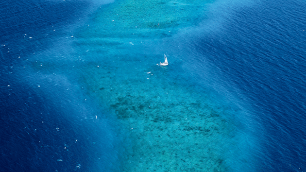
Tradewinds may be less stable, switch off or even reverse in El Niño. Photo: Lauric Thiault
Sebastian Wache, marine weather router (wetterwelt.de) and sailor, said he expects more hurricanes to develop in the Atlantic as the El Niño transitions into a La Niña. With this in mind, he suggests sailors returning to Europe start earlier next year to avoid the storms. However, he also cautioned that leaving too early could expose sailors to winter storms coming from Newfoundland and Canada.
“The cold air masses from Canada will meet the warm air masses from the Gulf Stream, and a very intensive, low pressure system develops,” Wache said. “In springtime, the northern hemisphere gets warmer and warmer due to the spring and going to summertime. The tropical high pressure system widens, and pushes out the low pressure system more and more to the north.”
“So it’s a very small weather window next year to have a safe trip from the Caribbean, over the Bermudas to the Azores,” Wache said, who recommends sailors plan to make the passage during May.
Due to its distance from the Pacific, the Mediterranean is not directly impacted by the El Niño. However, El Niño is associated with globally high temperatures, and this summer has already been a record heatwave in Europe. Increased sea temperatures in the Med could result in strong weather events, such as Medicanes, that tend to happen at the end of the summer.
For sailors monitoring how El Niño is affecting their route planning, Monges advises sailors to avoid relying solely on low-resolution weather prediction models, such as the Global Forecast System (GFS), and instead consult higher-resolution models that provide regional forecasts, and check for updates frequently.
“My main advice is to build more flexibility into a weather window rather than locking in a fixed date,” Monges said. “This matters everywhere, but especially in the Pacific this year where El Niño will have its strongest impact.”
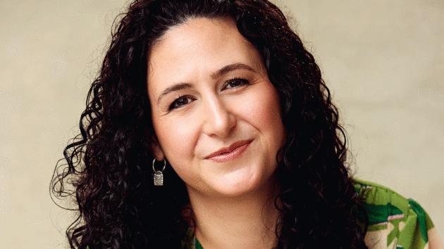
Elizabeth Alberts is an environmental journalist based in Glandore, Ireland. She is learning to sail in the village’s busy harbour and has previously sailed aboard PanExplore’s SV Sea Dragon, where she led a writing workshop on a voyage from the Dominican Republic to Florida. Photo: Veerle Scheppers Fotografie
 If you enjoyed this….
Yachting World is the world’s leading magazine for bluewater cruisers and offshore sailors. Every month we have inspirational adventures and practical features to help you realise your sailing dreams.Build your knowledge with a subscription delivered to your door. See our latest offers and save at least 30% off the cover price.
Note: We may earn a commission when you buy through links on our site, at no extra cost to you. This doesn’t affect our editorial independence.